pearl-disasters
 Vedant Mhatre
Description Urban regions frequently face localized disasters such as floods, heatwaves, and infrastructure failures. However, existing systems lack timely, community-driven prediction and response mechanisms, leading to delayed actions and increased damage. There is a need for a platform that enables better awareness, reporting, and response using available or simulated data. Objective To develop a platform that predicts and manages localized disasters using available or simulated data and community participation. Key Features Real-time disaster prediction using multiple data sources (or simulated inputs) Geo-tagged community-based incident reporting system Alert and notification system for risk zones Visualization of affected areas on interactive maps Quick reporting interface for users Integration-ready architecture for external data sources Offline-capable functionality for low-connectivity scenarios Expected Impact Enables faster disaster response Improves preparedness and awareness Reduces potential damage and risks make me creative website for this for my offline hackathon build an web app

Comments (0)
Sign in to leave a comment
System Requirements
System Requirements Document (SRD)
Project Name: pearl-disasters
1. Introduction
Urban regions frequently face localized disasters such as floods, heatwaves, and infrastructure failures. However, existing systems lack timely, community-driven prediction and response mechanisms, leading to delayed actions and increased damage. The pearl-disasters project aims to address this gap by developing a platform that predicts and manages localized disasters using available or simulated data and community participation.
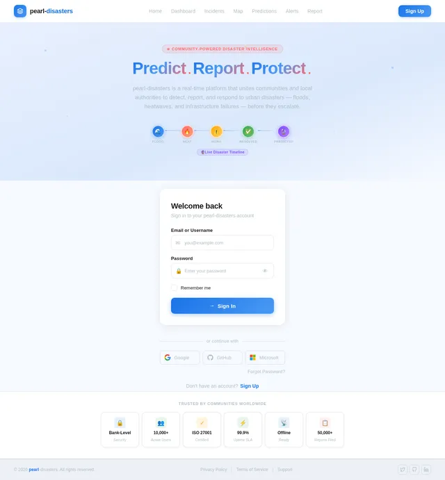
This document outlines the system requirements for pearl-disasters, a web application designed for Vedant Mhatre's offline hackathon. The platform will focus on real-time disaster prediction, community-based reporting, and interactive visualization tools to enhance disaster preparedness and response.
2. System Overview
The pearl-disasters platform will serve as a centralized hub for disaster prediction, reporting, and response. It will leverage real-time data, community inputs, and advanced visualization techniques to provide actionable insights to both local authorities and the general public.
Key features include:
- Real-time disaster prediction using multiple data sources or simulated inputs.
- Geo-tagged, community-based incident reporting system.
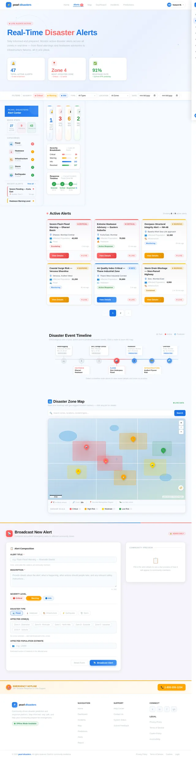
- Alert and notification system for risk zones.
- Interactive maps for visualizing affected areas.
- Offline-capable functionality for low-connectivity scenarios.
The platform will be designed to operate seamlessly across devices, ensuring accessibility and usability for all stakeholders.
3. Functional Requirements
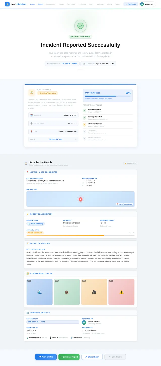
- As a User, I should be able to report incidents with geo-tagged locations.
- As a User, I should be able to view disaster-prone areas on an interactive map.
- As a User, I should receive alerts and notifications for risk zones.
- As an Admin, I should be able to manage and verify community-reported incidents.
- As an Admin, I should be able to integrate external data sources for disaster prediction.
- As a User, I should be able to access basic functionalities offline during low-connectivity scenarios.
- As a User, I should be able to view real-time disaster predictions based on available data.
4. User Personas
4.1 Community Member
- Role: General public user.
- Goals: Report incidents, stay informed about disaster-prone areas, and receive timely alerts.
- Technical Proficiency: Basic.
4.2 Administrator
- Role: Local authority or disaster management personnel.
- Goals: Manage incident reports, verify data, and oversee disaster prediction systems.
- Technical Proficiency: Intermediate to advanced.
5. Visuals Colors and Theme
The visual identity of pearl-disasters will reflect urgency, clarity, and community collaboration. Below is the unique color palette for the project:
- Background: #F5F9FF (Soft Sky Blue)
- Surface: #FFFFFF (Pure White)
- Text: #1A1A1A (Deep Charcoal)
- Accent: #FF6B6B (Emergency Red)
- Muted Tones: #B0BEC5 (Calm Gray)
This palette ensures readability and conveys a sense of urgency while maintaining a professional and approachable aesthetic.
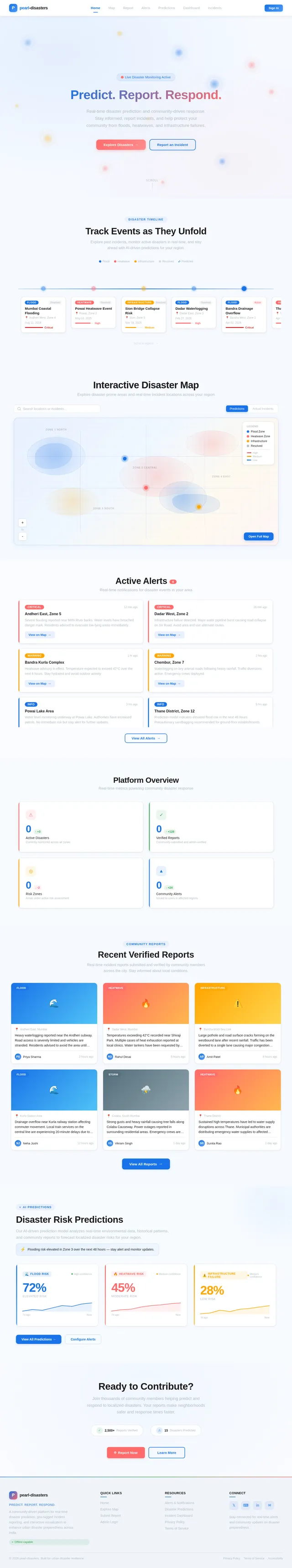
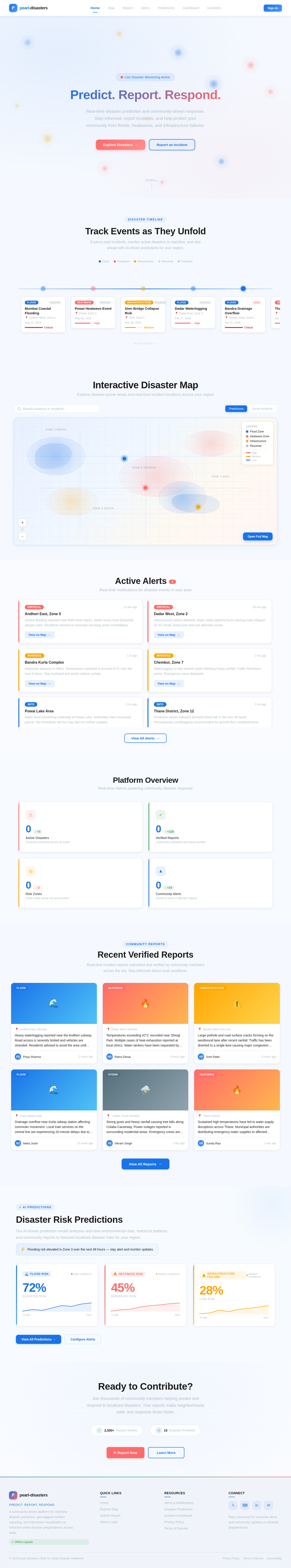
6. Signature Design Concept
The homepage of pearl-disasters will feature an interactive disaster timeline.
Concept Details:
- Visual Design: A dynamic, scrollable timeline that showcases past, present, and predicted disasters in the user's region. Each disaster event will appear as a clickable node on the timeline, with animations that simulate ripples or shockwaves when hovered over.
- Interactive Map Integration: The timeline will be paired with an interactive map that highlights affected areas in real-time. Clicking on a timeline node will zoom the map to the corresponding location.
- Micro-Interactions: Subtle animations, such as pulsing alerts for active disasters and fading transitions for resolved incidents, will enhance user engagement.
- Color Shifts: The background of the homepage will subtly change based on the type of disaster being viewed (e.g., blue for floods, red for heatwaves).
This design will make the platform visually striking and immediately engaging, leaving a lasting impression on users.
7. Non-Functional Requirements
- The system should support at least 10,000 concurrent users.
- The platform must be optimized for both desktop and mobile devices.
- The system should ensure data security and comply with local data protection regulations in India.
- The platform should load within 3 seconds on a standard 4G connection.
- Offline functionality should allow users to report incidents and view cached maps.
8. Tech Stack
Frontend
- React for Web
Backend
- Python
- FastAPI
Database
- MySQL (with Alembic for migrations)
AI Models
- GPT 5.4 for user-friendly responses
- Google Nano Banana for image generation
AI Tools
- Litellm for LLM Routing
- Langchain
Orchestration
- Docker for local orchestration
- Kubernetes for server-side orchestration
9. Assumptions and Constraints
- The platform assumes access to reliable disaster data sources or simulated inputs.
- Community members will have basic familiarity with smartphones and web applications.
- The system will initially target urban regions in India, with potential scalability to other regions.
- Offline functionality will be limited to reporting and viewing cached data.
10. Glossary
- Geo-tagging: Associating data with a specific geographic location.
- Interactive Map: A digital map that allows users to interact with data points, zoom, and navigate.
- Simulated Inputs: Artificially generated data used for testing or prediction purposes.
- LLM Routing: The process of directing queries to the most appropriate large language model.
- Orchestration: The automated arrangement and coordination of systems and services.
No comments yet. Be the first!